
")
Text by Henrylito D. Tacio
Photos: BFP-CAR and WHO
Some years back, the Philippine Congress released a study that said about 123,000 hectares of the country’s forest cover are lost every year. Unless reforestation is started, the study further stated, there would be no forest left in the country by 2036 – that’s exactly 15 years from now.
Then-President Benigno S. Aquino III, in his state of the nation address (SONA) in 2011, stated that most politicians use one possible solution – that of tree planting – as a photo opportunity. “They plant trees, but they do not ensure that the trees will remain standing after they leave,” he admitted.
When he was still the head of the Department of Environment and Natural Resources (DENR), Michael Defensor admitted that “only 30% of reforestation projects succeeded.” In a Subic meeting of local executives, he told them: “People hardly recognize the economic benefits from protecting the environment. Most sabotaged the program.”
The bluntness seemed to echo an earlier study of the Food and Agriculture Organization of the United Nations, entitled Sustainable Forest Management, which stated, “Most of the (Philippines’) once rich forest are gone. Forest recovery, through natural and artificial means, never coped with the destruction rate.”
There are several reasons why trees are cut extensively: logging (both legal and illegal), kaingin farming (slash-and-burn agriculture), and mining. Volcanic eruptions have also devastated some of the country’s tropical forests. Ditto for typhoons, which have destroyed considerable hectares of forest areas.
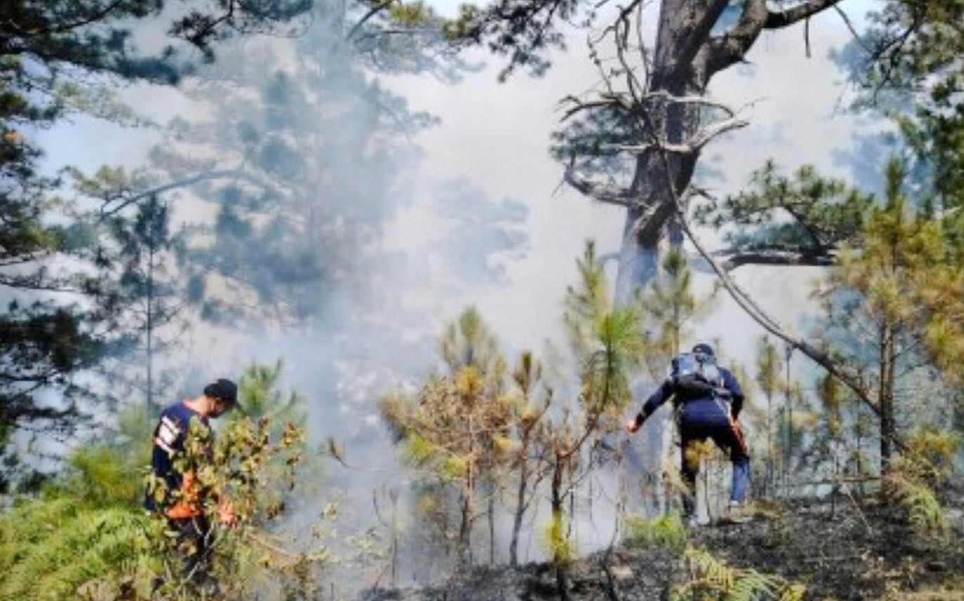
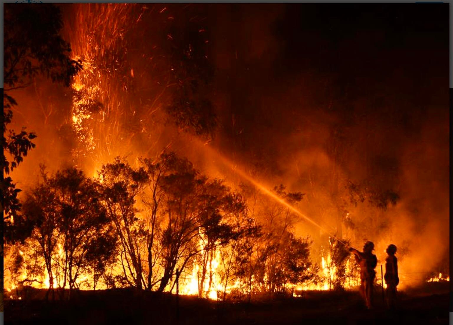
And there are forest fires. From 1978 to 1996, forest fires in the Philippines destroyed approximately 304,345 hectares, or an average of 16,000 hectares per year. From 1992 to 1996 alone, fire damage was estimated at P465 million.
During the pandemic, forest fire incidents went down: from 1,282 in 2019 to 429 in 2020. The Department of Environment and Natural Resources (DENR) attributed the decrease to lockdown measures.
“Forest fires are mostly fueled by human activities,” said DENR Acting Secretary Jim Sampula in a statement, adding that incidents of man-made forest fires increase during the dry season.
Man-made forest fire is usually an offshoot of swidden agriculture (slash-and-burn farming or kaingin), smoking of honeycombs to gather honey, indiscriminate throwing of cigarette butts, unattended burning of garbage, campers who are unable to control the fire from their food burners, and other forms of activities that involve fire.
In 2020, a wildfire destroyed about 1,000 hectares of pine forest near Mount Pulag in Benguet, according to a Philippine Star news report. The fire commenced in the jungles straddling the towns of Kabayan and Bokod.
“The native pine forests in Cordillera Administrative Region are fire-prone due to the frequent fires recorded in the past,” said the Laguna-based Philippine Council for Agriculture, Aquatic and Natural Resources Research and Development (PCAARRD).
“Uncontrolled fires result in enormous flames for weeks due to the rough hilly terrain and lack of applicable equipment and skilled personnel,” said PCAARDD, a line agency of the Department of Science and Technology (DOST).
Forest fires derail the country’s reforestation efforts. In 2020, 389 of the 429 forest fires happened in plantation sites under the Expanded National Greening Program (ENGP), covering 7,830 hectares valued at P119.3 million.
In response to these forest fires, the PCAARRD has developed science- and technology-based tools to help forest managers and other stakeholders in predicting the probability of fire occurrence.
“The fire behavior model simulates and predicts fire movements,” said the PCAARRD Information Bulletin No. 25. The tools are integrated with geographic information systems (GIS), remote sensing, a global positioning system (GPS), and Web innovations.
“These interactive disaster and hazard management models were programmed for easy information dissemination and will allow a location-specific application,” PCCAARRD explained PCAARRD.
“Using this web-enabled hazard decision support system, various maps – which can be resized on-screen and point-clicked with their corresponding attributes and statistics – can be accessed and generated,” it added.
Negative impacts and destruction brought by uncontrolled forest fires are unlimited. As such, preventing forest fires is better than any fire control measure. “Fire prediction is an important prevention measure,” PCAARRD said.
The PCAARRD-funded program enabled researchers to develop a forest fire hazard and behavior forecasting and a risk reduction system using GIS. Through the project, fire hazard maps were developed. The maps used the prediction equation, which combines a number of critical factors that significantly influence forest fires. These are: vegetation or land cover; proximity to farms; distance to roads; slope; and aspect.
Vegetation refers to the vegetative cover or current land use pattern which determines the kind, quantity, and quality of fuels present on site. Fuels present, as an element of the fire triangle, determine fire risks. “An element of the fire triangle is a model that shows the relationship between the essential elements of fire,” the information bulletin explained.
Proximity to farms and roads is a factor in the prediction equation due to previous fire incidents in farms and careless passers-by, and pranksters throwing lighting materials like lighted cigarettes.
The area’s slope, meanwhile, enhances burning since “the steeper slope promotes rapid spread of fire upslope.”
The aspect refers to the horizontal direction where the mountain slope faces. “The aspect is also considered because drying of fuels is more prevalent along east-west slopes than north-south facing slopes,” the PCAARRD publication informed.
According to PCAARRD, highly vulnerable, vulnerable, and less vulnerable sites are identified on the calibrated maps.
“Through these fire hazard maps, forest managers and other stakeholders will be properly guided on fire risks, especially during fire season (summer months),” it said.
Forest managers include the forest protection unit of the Department of Environment and Natural Resources (DENR) and local government units.
The PCAARRD publication suggests that practices causing fire ignition (like slash and re-growth of grass for grazing purposes) should not be allowed during the fire season in places adjacent to high-risk areas. Proper local ordinances and their strict implementation can help lessen the chances of fire.
“If coupled with appropriate information, education and communication strategies and replicated in other areas, these hazard maps will hopefully make every barangay (village) ready and responsive to forest fires,” the PCAARRD publication concluded.
At the Cordillera Administrative Region, the PCAARRD is funding a project that protects watersheds against forest fires through greenbelt establishment using maguey (Agave cantala).
The three-year project, now in its second year, is on track with its work plan: it has established maguey nurseries producing 11,264 suckers/bulbils. It had also trained 14 local government officials and 58 farmers on climate change adaptation and greenbelt establishment.
One good news is that two seed production areas had been protected from forest fires through the planting of maguey in 2.56-kilometer greenbelts in Bokod and Tublay.
“Seed production areas are targets for forest fire protection since they serve as seed sources for the production of quality planting materials for reforestation (in the region),” the PCAARRD said.