

Text by Henrylito D. Tacio
Photos: DENR
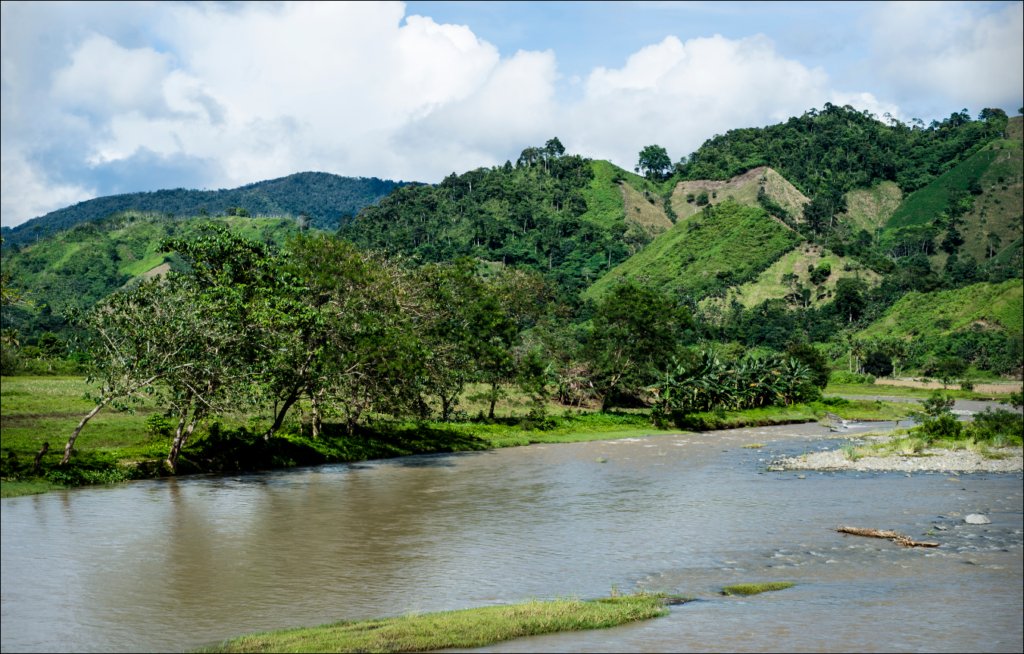
The Tagum-Libuganon River in Davao del Norte is one of the two rivers where ecosystem-based management will be implemented, according to the Department of Environment and Natural Resources (DENR).
The DENR signed a technical cooperation agreement for the implementation of the Ecosystem-based Adaptation in River Basins (E2RB) project with the Deutsche Geselschaft fur Internationale Zusammenarbeit (GIZ).
The other river, Ilog-Hilabangan, is located on Negros Island. The aim of the project is to reduce the vulnerability of both rivers to climate change and natural disasters.
DENR’s River Basin Control Office (RBCO), the implementation partner of the project, initiated some activities last year despite challenges brought about by the coronavirus disease 2019 (COVID-19) pandemic.
“A Project Management Committee has already been created,” said RBCO Executive Director Nelson V, Gorospe. “We can start implementation this year after some delays due to Covid 19.”
According to the press statement released last January 7, the Philippine government received an E4.6 million grant from the German government for the ER2B. The German Federal Ministry of Environment, Nature Conservation, and Nuclear Safety through the International Climate Initiative has commissioned GIZ to implement the project.
The project, it is said, “will strengthen the river basins’ ecosystem services, protect their biodiversity, and importantly, reduce their vulnerability to climate change as destructive flooding has been experienced in the river basins.”
Gorospe said that “one of the basis for the choice of the site is perennial flooding.”
E2RB is in line with DENR’s program on Climate Change Adaptation and Mitigation and Disaster Risk Reduction Roadmap 2018-2022. It also aligns with the Philippine Development Plan 2017-2022, Philippine Biodiversity Strategy and Action Plan, and enhanced National Greening Program (NGP).
“The effective protection of forests in river basins supports the objectives of the Philippine intended Nationally Determined Contributions (INDC) in the area of mitigation through the contribution of the forest sector to the planned total greenhouse gas reduction of 70% in 2030,” stated the DENR-GIZ implementation agreement.
The Tagum-Libuganon River basin has a total area of 3,119 square kilometers and it traverses two regions: Region 11 (Davao del Norte) and Region 13 (Agusan del Sur). About 209 barangays from 19 towns and cities are directly involved with the river, whose outlet is the Davao Gulf. Its estimated terrain elevation above sea level is 13 meters.
The river basin covers 1,776.06 square kilometers of forest land and 1,365.27 square kilometers classified as alienable and disposable. As of October 2015, the NGP area is 130.50 square kilometers.
Most of the length of the river can be found in Davao del Norte. With a total length of 95 kilometers, it is the longest among the major rivers in the province and has a total watershed area of 247,500 hectares.
According to the Tagum-Libuganon River Basin Management Council, the environmental issues and problems the river confronts are as follows: insufficient water supply, deforestation, and watershed degradation, illegal extraction of mineral resources, and frequent flooding.
Other problems include soil erosion and siltation, improper waste disposal, water pollution, and informal settlers in easement areas.
Among the strategies identified are: integrated watershed management, biodiversity conservation, water resources management, river and river delta management, and flood control, disaster risk reduction, and hazard management.
The following strategies have also been identified: climate change adaptation and mitigation, coastal and aquatic resources management, mineral resources management, and community participation.
Secretary Fortunato Dela Peña of the Department of Science and Technology (DOST) cited climate change as the primary culprit of the sudden surge of stronger floods brought in recent years. “Climate change is one of the reasons why floods have become intense and consistent these days,” he said.
Other causes of the recent flooding include garbage thrown anywhere, thereby locking the waterways, constructing buildings in areas where waters used to drain before, cutting of trees, and some government policies.
Of all these causes, according to Dela Pena, the climate-change typhoons remain as the harbinger of floods. From 1990 to 2006, the Philippines reportedly experienced record weather-related disasters, including the strongest typhoon, the most destructive typhoons, the deadliest storm, and the typhoon with the highest 24-hour rainfall on record.
“These events are projected to continue to intensity, requiring the Philippines to improve its climate resilience and develop its adaptive capacity to alleviate the risk of catastrophic economic and humanitarian impacts,” the World Bank report suggests.
One government official puts it: “There is no better way of protecting our people from floods, slides and other hazards brought by typhoons than making them aware and ready on what to do when these situations arise.”