Text and Photo by Henrylito D. Tacio
Additional photos courtesy of IDS-Comval
Just like the very popular American television sitcom Three’s a Company, disaster is also like that. In the Philippines, disaster comes together in three forms: when there’s a typhoon, expect too much rain, and inundating floods.
Typhoons Sendong and Pablo, which hit Mindanao, were only a preview of the things to come. Both were described as “super typhoons,” thus they caused extensive devastation to Northern Mindanao (particularly the cities of Cagayan de Oro and Iligan) and Southern Mindanao (mostly in Davao Oriental and Davao de Oro).
But it’s the super typhoon that most Filipinos are familiar with. It was the “strongest typhoon in the world” in 2013, according to Dr. Flaviana Hilario of the research and development office of the Philippine Atmospheric, Geophysical, and Astronomical Services Administration (PAGASA).
The US-based Joint Typhoon Warning Center (JTWC) recorded Yolanda’s average strength at 195 miles per hour (314kilometers per hour) at landfall, beating the previous record set in 1969 by Hurricane Camille, which carried 190 mph (306 kph) winds when it landed in Mississippi in the US.
On record, though, Yolanda is the fourth strongest tropical cyclone in world history in terms of overall strength, according to Jeff Masters in his weather website, wunderground.com. The all-time record is still held by Super Typhoon Nancy in 1961 at 215 mph (346 kph), followed by Super Typhoon Violet in the same year at 205 mph (323 kph), and Super Typhoon Ida in 1958 with 200 mph (322 kph).
As more typhoons are expected to hit the country before the year ends, floods will become a common thing in Metro Manila, Bicol Region, and other low-lying areas in the Philippines.

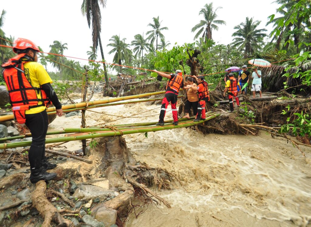
Rescuing flood victims (Photo by IDS-Comval) 
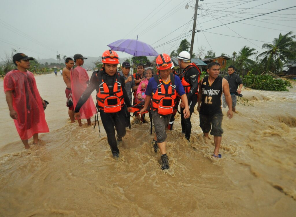
Flood in Compostela Valley (Photo by IDS-Comval)
A flood is defined as “an overflow of water that submerges land which is normally dry.”
“Floods are due to the complex combination of weather, climatic and human activities,” explained Rosalie Pagulayan, weather specialist II of the Philippine Atmospheric, Geophysical and Astronomical Services Administration (PAGASA), during a seminar-workshop convened by the Department of Science and Technology in Davao City some years back. “Most floods occur as a result of moderate-to-large-scale rainfall events.”
Actually, given the location and the topography of the country, the Philippines experiences five weather-causing phenomena which can bring floods any time of the year. These are thunderstorms, cold front, monsoons, intertropical convergence zone (ITCZ), and tropical cyclones.
Thunderstorms, called local storms, occur when towering cumulus clouds reach a height where the temperature is well below the freezing point. Among the associated hazards are heavy rain (which may cause flash floods) and lightning (which may cause death, burns, or fire).
A cold front is formed when cold air moves over areas of warm air, according to the country’s weather bureau. Since cold air is heavier than warm air, the warm air is pushed aloft by the cold air giving rise to widespread cloudiness. The cold front affects the eastern part of the country from November to late April or early May.
There are two types of monsoon that hit the country: Southwest and Northeast. In the former, the Asiatic continent becomes warmer than the surrounding seas, and a low-pressure cell develops over the continent. This causes a flow of moist southwest wind over the Philippine area. At times, when this southwest flow becomes thick in-depth, it persists for a long period causing continuous rains, which may last for weeks during the months of June to September. The Southwest monsoon is responsible for the great portion of rainfall during the country’s wet season.
In the Northeast monsoon, the Asiatic continent is snowbound, and the high-pressure cell over China sends northeasterly winds over the Philippines, giving the country cold temperatures and causing much rainfall over the eastern coasts. This happens from November to February.
Known by sailors as the doldrums, the ITCZ is an area where the northern hemisphere trades meet the southern hemisphere trades. According to the weather bureau, ITCZ is characterized by towering clouds of cumulonimbus clouds accompanied with showers of widespread thunderstorms.
“The axis of convergence, which is usually oriented in an east to west direction, does not remain stationary at the equator but migrates north or south of the equator,” explains a PAGASA’s briefing paper. In the Philippines, it oscillates during the months of May to October.
Tropical cyclones are low-pressure systems characterized by relatively low atmospheric pressure at the center with very strong winds blowing counterclockwise (in the northern hemisphere) towards and around the center. The 1972 flood in Central Luzon was due to four storms that hit the region from July to August. The 1991 flash flood that happened in Ormoc City was due to Typhoon Uring.
“Each year, about 20 tropical cyclones enter our country,” says PAGASA’s Rene Paciente. Fortunately, only 6 to 9 of these tropical cyclones make landfall.
All these weather disturbances bring a lot of water causing flooding in affected areas. The same thing happens when there is a storm surge, “a rise of seawater above the normal level on the coast generated by the action of the wind and atmospheric pressure, associated with the occurrence of a tropical cyclone.”

According to the PAGASA briefing paper, a storm surge can inundate low-lying coastal communities as the level of the ocean is raised by several feet. This happened in Metro Manila in 2011 when large waves that hammered the coastline of Manila Bay caused flash floods in areas. The huge waves caused by the storm surge battered the bay’s seawall, causing portions of the wall to collapse.
Likewise, high tide that coincides with high stream flows can aggravate flooding near the coasts. Some years back, torrential rains inundated many barangays in Davao City as Bankerohan River overflowed and submerged houses along river banks, displacing hundreds of residents.
A really big flood can cause billions of pesos in damage to agriculture, infrastructure, loss of productivity in industry and commerce, not to mention the loss of human lives. Congested urban centers like Metro Manila could standstill for days.
“With too much rain and floods, agriculture production especially in flood-prone areas will be adversely affected with physical and economic losses,” pointed out Dr. Rafael D. Guerrero, a national scientist with the National Academy of Science and Technology (NAST). “Floods will wash away crops, hasten soil erosion and increase crop spoilage due to poor storage and distribution problems.”
The Department of Health said floods will accelerate food-borne and water-borne diseases. “Flooding can contaminate the public water through the disruption of water purification and sewage disposal systems, rupture of underground pipelines and storage tanks,” the health department said.
Using contaminated water can cause a wide spectrum of illnesses, among them: acute gastroenteritis, dysentery, typhoid fever, cholera, and hepatitis A. “Foods that may have been in contact with contaminated flood water should not be eaten,” the health department advised.
In addition, there is an increase of leptospirosis cases after heavy rains or flooding incidents. This livestock disease transmissible to many may be acquired through wading in water contaminated with urine of infected animals.
As floods are common throughout the country, the weather bureau has launched the Flood Early Warning System (FEWS) capacities. It has five basic elements: prediction, detection, communication, decision-making, and mobilization.
“In any disaster of given magnitude, the first line of defense is still awareness of the communities at risk,” reminded Pagulayan.
Another PAGASA briefing paper shared some safety tips before flooding, during the flood, and after the flood. It said that when warned of floods, the following should be done. Securely anchor weak houses. Drinking waters must be stored in containers as water service may be interrupted. Household belongings should be moved to upper levels while livestock are bought to higher grounds.
Should there be advice of an evacuation, it must be followed. “Do not panic, move to a safe area before access is cut-off by floodwaters,” it said. “Turn off the main electricity switch and gas valve, and lock your house before evacuating.”
Before flooding occurs, keep these in mind: Keep informed of the daily weather conditions and forecast from the weather bureau. Be aware of how often your location is likely to be flooded and to what extent. Know the flood warning system and evacuation plan of your community and make sure your family knows them. Designate an evacuation area for the family and livestock and assign family members specific instructions and responsibilities according to an evacuation plan. Keep a stock of food that requires no or little cooking and refrigeration, good at least for three days. Keep a transistorized radio and flashlight with spare batteries, emergency cooking equipment, candles, matches, and first aid kid hand in case of emergency.
During the flood, stay indoors. Do not attempt to cross rivers with flowing streams where water is above the knee. Beware of water-covered roads and bridges. Do not go swimming or boating in swollen rivers. Beware of contaminated food and water.
After the flood, here are the things you need to do: Reenter the house with caution using flashlights. Flammables and dangerous animals like snakes may be inside. Be alert for fire hazards like broken electric wires. Do not eat food and drink water until they have been checked for floodwater contamination.
Report broken utility lines (electricity, water, gas, and telephone) to appropriate agencies or authorities. Do not turn on the main switch or use appliances and other equipment until they have been checked by a competent electrician. Do not go “sight-seeing” in a disaster area. Your presence might hamper rescue and other emergency operations.
It’s the rainy season again – and forearmed is forewarned. Listen to the woes of one flood victim: “The downpour of rain is unprecedented. The rain came without much warning. When we woke up in the morning, there was intermittent heavy rain and I thought that it is seasonal – indeed the rainfall throughout this year has been quite heavy, unlike during the last three years. The rain water reached two feet on the main streets. I couldn’t drive, there was water everywhere.”

