

Text and Photos by Henrylito D. Tacio
The Philippines, with more than 7,000 islands, is one of the most vulnerable countries in the world to weather-related extreme events, earthquakes, and sea-level rise.
“Absent of land barriers, the Philippines is exposed directly to multiple climate-related hazards such as typhoons (in the northern and eastern parts), floods (in central Luzon and southern Mindanao), landslides (based on terrain), and droughts, making the Philippines more vulnerable to climate risks than other Southeast Asian countries,” pointed out the World Bank report, Getting a Grip on Climate Change in the Philippines.
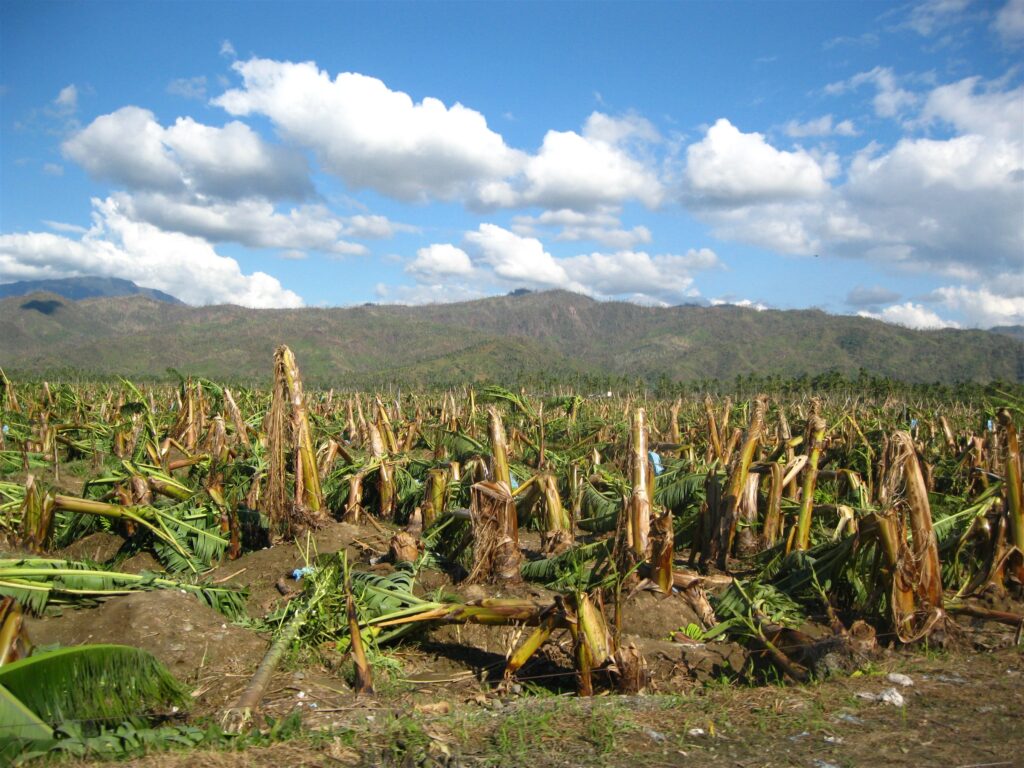
In the last several years, the country has suffered extreme weather events, including prolonged dry spells, heavy rains, and strong typhoons and floods. These problems are aggravated by harmful practices that have led to the destruction of forests, mangroves and corals, and the deterioration of the environment in general. Even some Mindanao areas that were considered “typhoon-free” had been hit by powerful typhoons, floods, and mudslides.
Each year, about 20 tropical cyclones – locally known as “bagyo” – enter the Philippine area of responsibility. “By the end of this century, tropical cyclones are expected to intensify, with a projected increase in the average instantaneous maximum wind velocity at the Philippine coast,” the World Bank report states.
Floods, which often accompany typhoons, are likely to create havoc among informal settlers, which account for 45 percent of the country’s urban population. “(They) are particularly vulnerable to floods due to less secure infrastructure, reduced access to clean water, and lack of health insurance,” the World Bank report states.
In 1991, Ormoc City in Leyte was once devastated by a colossal flood, killing about 8,000 people, wherein half of the victims’ bodies were never recovered. Walls of mud and water emanating from mountains washed away shanties and swept people into the sea, a tragedy that brought lamentations all over the place and in the whole Philippines.
Secretary Fortunato Dela Peña of the Department of Science and Technology (DOST) cited climate change as the primary culprit of the sudden surge of more substantial floods brought in recent years. “Climate change is one of the reasons why floods have become intense and consistent these days,” he said.
Other causes of the recent flooding include garbage thrown anywhere, thereby locking the waterways, constructing buildings in areas where waters used to drain before, cutting of trees, and some government policies.
Of all these causes, according to Dela Pena, the climate-change typhoons remain as the harbinger of floods. From 1990 to 2006, the Philippines reportedly experienced record weather-related disasters, including the strongest typhoon, the most destructive typhoons, the deadliest storm, and the typhoon with the highest 24-hour rainfall on record.
“These events are projected to continue to intensity, requiring the Philippines to improve its climate resilience and develop its adaptive capacity to alleviate the risk of catastrophic economic and humanitarian impacts,” the World Bank report suggests.
One government official puts it: “There is no better way of protecting our people from floods, slides and other hazards brought by typhoons than making them aware and ready on what to do when these situations arise.”
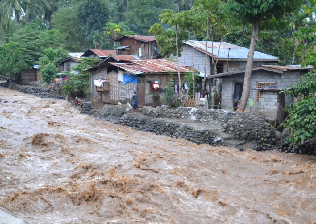
Flooding 
Houses in hazardous area
In Mindanao, home to more than 22 million Filipinos, the DOST has launched the Geo-Informatics for the Systematic Assessment of Flood Effects and Risks Towards a Resilient Mindanao or Geo-SAFER Mindanao. It is initiated by five higher education institutions: Ateneo de Zamboanga University (AdZU), Central Mindanao University (CMU), Mindanao State University – Iligan Institute of Technology (MSU-IIT), Caraga State University (CSU), and the University of the Philippines – Mindanao (UP-Min).
Actually, Geo-SAFER is an expansion of the Phil-LiDAR 1 Project that aims to produce highly detailed flood hazard maps. Using the state-of-the-art technology of Light Detection and Ranging (LiDAR) equipment, it can generate detailed topographic maps of 71 river basins and flood-prone areas of the 135 cities and municipalities of Mindanao.
LiDAR is a remote sensing method “that uses light in the form of a pulsed laser to measure ranges (variable distances) to earth.” These light pulses – combined with other data recorded by the airborne system – generate precise, three-dimensional information about the shape of the earth and its surface characteristics.
According to experts, LiDAR map generation is a cost-effective means of acquiring accurate data on elevation and depth, two things critical in determining the risk of flooding.
Let’s take the Geo-SAFER Agusan Project as a case in point.
“We will mainly process and analyze very detailed LiDAR-derived digital terrain and surface models and then use these inputs to numerical simulation models for hydrologic and hydraulic characterization of the basin and to produce detailed flood hazard maps for different flood scenarios,” explains Engr. Meriam Makinano-Santillan, the project leader of Geo-SAFER Agusan.
In addition, the project will add some innovations that put particular attention explaining specific issues and problems pertaining to the flooding problem in the basin, such as the roles of anthropogenic activities like mining, deforestation, and land-use conversions in the hydrologic and hydraulic characteristics of the basin.
If you are still wondering how it will be done, here are the major activities in flood hazard mapping using LiDAR:
First, a field survey will be conducted. Among the information to be gathered include how much rain falls into the watershed, how wide and deep the river is, how fast the water flows, and how much water flows along the river. Then the project conducts river cross-section surveys, LiDAR data validation surveys, underwater depth surveys, and flow measurements through the installation of rain gauges, water level sensors, and velocity meters.
A LiDAR data processing will also be processed to generate digital terrain models (DTMs) and digital surface models (DSMs). LiDAR validation and data of underwater depth of the river gathered are also processed to assess the accuracy of the LiDAR products and to incorporate data into the DTMs.
Also gathered are DSMs features like houses, buildings, roads, and bridges, which are all utilized for mapping structures at risk of flooding.
Once all the above are at hand, numerical simulation models (rainfall events of varying depth, duration, and intensity) are developed and applied to predict flooding. DTMs and information gathered from the DSMs are used during the flood modeling process to generate flood models and flood hazard maps.
In addition, all the information gathered in the field to calibrate and validate the flood model computations and assess whether the flood hazard maps generated by the models are realistic and accurate or not.
In his keynote address during the launching of Geo-SAFER Mindanao in Butuan City recently, Science Secretary Fortunato T. Dela Peña said: “Actually, we really cannot control disasters from knocking at our doors, however, we can mitigate its effects unto us by being aware and prepared.”
“How can we be prepared?” he asked. “One way is by using the flood hazard maps. Hypothetical flood hazard maps of different rainfall scenarios are very useful during an impending flooding event. Since these flood hazard maps are very detailed, it reflects accurate information that can be relied on to prepare ourselves before flooding reaches our doorsteps.
“These hypothetical flood hazard maps are categorized by different rainfall amounts and its corresponding chances of occurring in a year. Therefore, for every rainfall event, we can view a specific type of map for reference. By seeing those maps, we can identify which areas can be affected by the upcoming flooding hence; we can prepare beforehand and mitigate the risks caused by flooding.”